
Origin time 14:14:42 UTC Depth 15 km (9.3 mi) Areas affected Puerto Rico Date 11 October 1918 | Magnitude 7.1 Mw Type Unknown Total damage $4–29 million USD | |
 | ||
Similar 1922 Vallenar earthquake, 1897 Assam earthquake, 1946 Dominican Republic, 1968 Illinois earthquake, 1950 Assam–Tibet earthquake | ||
The 1918 San Fermín earthquake, also known as the Puerto Rico earthquake of 1918, struck the island of Puerto Rico at 10:14:42 local time on October 11. The earthquake measured 7.1 on the moment magnitude scale and IX (Violent) on the Mercalli intensity scale. The mainshock epicenter occurred off the northwestern coast of the island, somewhere along the Puerto Rico Trench.
Contents
The earthquake triggered a tsunami with waves measured that swept the west coast of the island. The combined effects of the earthquake and tsunami made it one of the worst natural disasters that have struck the island. The losses resulting from the disaster were approximately 76–116 casualties and $4–29 million in property damage.
EarthquakeEdit
The epicenter of the 1918 Puerto Rico earthquake was located in the Mona Passage off the northwestern coast of the island. The strongest ground shaking has been estimated at intensity IX on the Mercalli intensity scale. The resulting tsunami affected primarily the west coast towns of the island (primarily Mayaguez).
DamageEdit
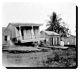
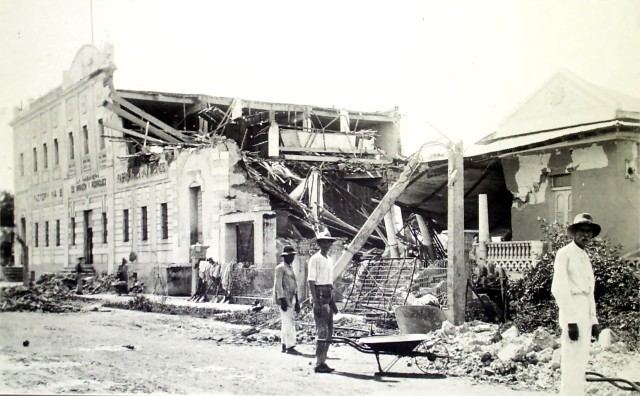
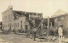
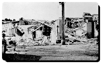
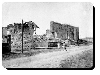
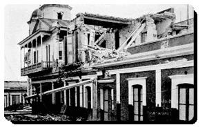
Numerous structures in the west coast suffered irreparable damage. Factories and production facilities were virtually destroyed, while bridges and roads were severely damaged. The earthquake caused several mudslides in areas where the intensity exceeded Level VII, but none caused numerous deaths. Also, the river currents were affected, which, in many cases affected the foundations of many bridges, resulting in their collapse. Telegraph cables under the ocean were damaged, cutting off the island from outside communication for a time.
The reported casualties of the earthquake have been estimated somewhere between 76 and 116 deaths. Approximately 40 of these deaths were caused by the tsunami which swept shore communities. Damage to property was estimated to be between $4 and 29 million.
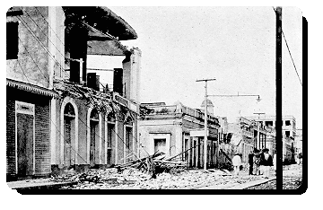
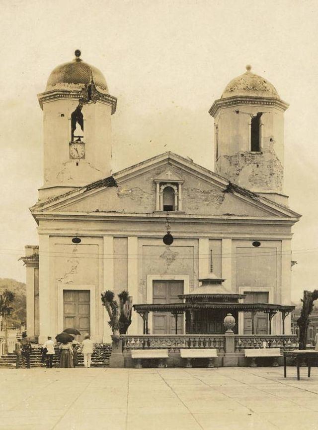
In Mayagüez, the largest city affected, 700 masonry buildings were damaged and 1,000 wooden houses, so many people were homeless. Major buildings like the church, post office and hall were severely damaged. With fear because of the aftershocks, many people camped out in the hills for weeks.
TsunamiEdit
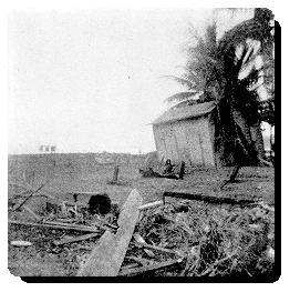
As a result of the earthquake, a tsunami lashed the west coast of the island, probably 4–7 minutes after the main shock. The highest waves were measured at 20 ft and destroyed several coastal villages. It has been estimated that 40 people were drowned as a direct result of the tsunami. The tsunami reached Galveston, Texas, where it registered as a disturbance on tide gauges.
AftershocksEdit
Several aftershocks were reported immediately after the main earthquake. On October 24 and November 12, two strong aftershocks were reported in the island. However, no damage was reported as a result.