
Area 26.74 km² | Postal code 58263 Elevation 545 m | |
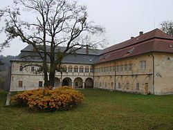 | ||
Ždírec nad Doubravou is a town in Havlíčkův Brod District in the Vysočina Region of the Czech Republic.
Map of %C5%BDd%C3%ADrec nad Doubravou, Czechia
The town covers an area of 26.74 square kilometres (10.32 sq mi), and has a population of 3,100 (as at 1 August 2009).
Ždírec nad Doubravou lies approximately 20 kilometres (12 mi) north-east of Havlíčkův Brod, 37 km (23 mi) north-east of Jihlava, and 109 km (68 mi) south-east of Prague.
References
Ždírec nad Doubravou Wikipedia(Text) CC BY-SA