
Country Czech Republic District Olomouc Elevation 232 m | Region Olomouc Postal code CZ - 783 13 Area 26.84 km² Population 3,393 (2012) | |
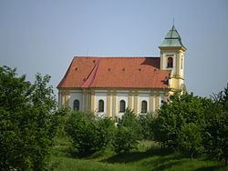 | ||
Štěpánov is a village and municipality (obec) in the Olomouc District in the Olomouc Region of the Czech Republic. The municipality is made up of the villages of Štěpánov, Benátky, Březce, Moravská Huzová and Stádlo (historic mentions also refer to their German names: Stepanau, Benatek, Bresetz, Mährisch Hause and Staadt).
Map of %C5%A0t%C4%9Bp%C3%A1nov, Czechia
The municipality covers an area of 26.84 square kilometres (10.36 sq mi), and has a population of 3,343 (as of 3 July 2006).
Štěpánov lies approximately 10 kilometres (6 mi) north of Olomouc and 206 km (128 mi) east of Prague.
References
Štěpánov (Olomouc District) Wikipedia(Text) CC BY-SA