
Country Turkey Elevation 630 m (2,070 ft) Postal code 27850 Population 2,990 (2012) Province Gaziantep Province | District Nurdağı Time zone EET (UTC+2) Licence plate 27 Area code 0342 | |
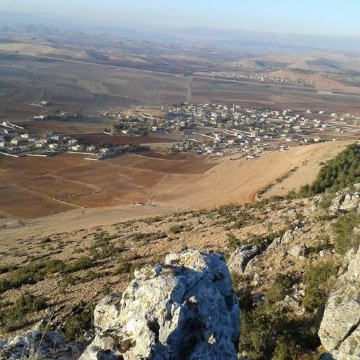 | ||
Şatırhüyük is a town in Nurdağı district of Gaziantep Province, Turkey. It is situated at the point where western the slopes of the Sofdağ Mountains meet the plains. The coordinates of the town are 37°13′N 36°59′E. Distance to Nurdağ (to the west) is 23 kilometres (14 mi) and to Gaziantep (to the southeast) is 57 kilometres (35 mi). The population of the town was 3149 as of 2012. The name of the town means merry tumulus referring to a tumulus in the center of the town . This history of this tumulus may be related to various ruins in Sakçagözü, another town 7 kilometres (4.3 mi) to south. Şatırhöyük is one of the wealthier towns of Gaziantep Province. The land is fertile and many crops including cereal and grapes are produced.
Map of %C5%9Eat%C4%B1rh%C3%BCy%C3%BCk Mahallesi, Nurda%C4%9F%C4%B1%2FGaziantep, Turkey
References
Şatırhüyük Wikipedia(Text) CC BY-SA