
Country Japan Prefecture Nagano Phone number 0264-55-3080 Population 3,773 (Oct 2016) | Region Chūbu (Kōshin'etsu) District Kiso Area 234.5 km² Local time Monday 1:32 AM | |
 | ||
Time zone Japan Standard Time (UTC+9) Weather -2°C, Wind NE at 3 km/h, 93% Humidity Points of interest Kiso Mountains, Mount Utsugi, Mount Sannosawa, Ookuwa Village, Joshoji | ||
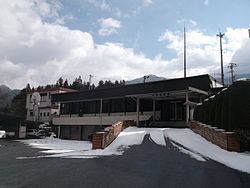
Ōkuwa (大桑村, Ōkuwa-mura) is a village located in Kiso District in south-west Nagano Prefecture, in the Chūbu region of Japan. As of 1 October 2016, the village had an estimated population of 3,773 and a population density of 16.1 persons per km². Its total area was 234.47 square kilometres (90.53 sq mi).
Contents
- Map of Okuwa Kiso District Nagano Prefecture Japan
- Geography
- Surrounding municipalities
- History
- Education
- Railway
- International relations
- Highway
- References
Map of Okuwa, Kiso District, Nagano Prefecture, Japan
Geography
Ōkuwa is located in the Kiso Mountains of southwest Nagano Prefecture, bordered by the Atera Mountains to the west. The Kiso River flows through the village. Mount Utsugi (2864 meters) and Mount Minamikoma (2841 meters) are on the border of the village.
Surrounding municipalities
History
The area of present-day Ōkuwa was part of ancient Shinano Province. The area developed as Suhara-juku and Nojiri-shuku two post stations on the Nakasendō highway connecting Edo with Kyoto during the Edo period. The modern village of Ōkuwa was established on April 1, 1889 by the establishment of the municipalities system.
Education
Ōkuwa has one public elementary school and one public middle school operated by the town government. The village does not have a high school.