
Country Japan District Taki Area 362.9 km² Local time Monday 1:00 AM | Region Kansai Phone number 0598-82-3781 Population 10,132 (Sep 2012) Prefecture Mie Prefecture | |
 | ||
Time zone Japan Standard Time (UTC+9) Address 750 Sahara, Ōdai-chō, Taki-gun, Mie-ken 519-2404 Weather 2°C, Wind W at 3 km/h, 85% Humidity Points of interest Okuisemiyagawa Hot Spring, Dokura Falls, Yanagiharakannonsenpuku Temple | ||
Ōdai (大台町, Ōdai-chō) is a town located in Mie Prefecture, Japan. As of September 2012, the town had an estimated population of 10,132 and a population density of 27.9 persons per km². The total area was 257.01 km².
Contents
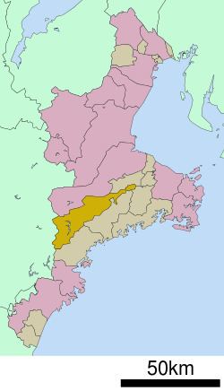
- Map of Odai Taki District Mie Prefecture Japan
- Geography
- Neighboring municipalities
- History
- Economy
- Railway
- Highway
- Local attractions
- References
Map of Odai, Taki District, Mie Prefecture, Japan
Geography
Ōdai is located in southeastern Kii Peninsula in central Mie Prefecture. An inland municipality, Ōdai extends almost the width of Mie Prefecture from east to west, but is narrow north to south.
Neighboring municipalities
History
The town of Ōdai was established on September 30, 1956 by the merger of the towns Kawazoe and Misedani, both in Taki District. On January 1, 2006, the last remaining village in Mie Prefecture, Miyagawa Village, merged with Ōdai.
Economy
Ōdai serves as a commercial center for the surrounding region.
Railway
Highway
Local attractions
References
Ōdai, Mie Wikipedia(Text) CC BY-SA