
Gmina Łagiewniki Local time Sunday 2:51 PM | Population 2,900 | |
 | ||
Weather 21°C, Wind NW at 13 km/h, 39% Humidity Voivodeship | ||
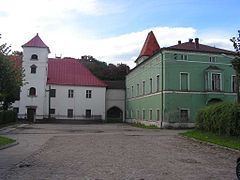
Łagiewniki [waɡʲɛvˈɲikʲi] (German: Heidersdorf) is a village in Dzierżoniów County, Lower Silesian Voivodeship, in south-western Poland. It is the seat of the administrative district (gmina) called Gmina Łagiewniki. It lies approximately 23 kilometres (14 mi) east of Dzierżoniów and 40 km (25 mi) south of the regional capital Wrocław.
Map of %C5%81agiewniki, Poland
Prior to 1945 it was in Germany. After World War II the region was placed under Polish administration by the Potsdam Agreement under territorial changes demanded by the Soviet Union. Germans fled or were expelled and replaced with Poles expelled from the Polish areas annexed by the Soviet Union.
The village has a population of 2,900.
From 1975 to 1998 the village was in Wrocław Voivodeship.
References
Łagiewniki, Lower Silesian Voivodeship Wikipedia(Text) CC BY-SA