
Area 16.28 km² | Postal code 582 87 to 584 01 Elevation 545 m | |
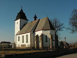 | ||
Číhošť ( [ˈtʃiːɦoʃc]; German Čihošt, from 1939: Tschihoscht) is a village and municipality (obec) in Havlíčkův Brod District in the Vysočina Region of the Czech Republic.
Map of %C4%8C%C3%ADho%C5%A1%C5%A5, Czechia
The municipality covers an area of 16.28 square kilometres (6.29 sq mi), and has a population of 336 (as at 3 July 2006).
Číhošť lies approximately 23 kilometres (14 mi) north-west of Havlíčkův Brod, 43 km (27 mi) north-west of Jihlava, and 77 km (48 mi) south-east of Prague.
Near the village lies the officially calculated geographical centre of the Czech Republic.
References
Číhošť Wikipedia(Text) CC BY-SA