
Highest elevation 340 m (1,120 ft) District Îles Kerguelen Elevation 340 m Max length 12.8 km | Archipelago Îles Kerguelen Highest point K13 volcano Population 0 Area 43 km² | |
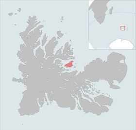 | ||
Île du Port is one of the Kerguelen Islands situated in the Golfe des Baleiniers off the north coast of Grande Terre, the main island.
Map of Port Island, French Southern and Antarctic Lands
It is the fourth largest island in the archipelago (43 km²). The highest point is a volcano named K13, at 340 metres.
References
Île du Port Wikipedia(Text) CC BY-SA