
Location Gironde, Landes Surface area 55 km (21 sq mi) Settlements Cazaux, Sanguinet Surface elevation 12 m | Basin countries France Max. depth 23 m (75 ft) Area 55 km² Cities Sanguinet, Cazaux | |
 | ||
Similar Lac de Biscarrosse et de Par, Dune of Pilat, Pyla‑sur‑Mer, Arcachon Bay, Réserve Ornithologique Du Teich | ||
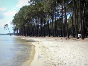
Étang de Cazaux et de Sanguinet is a lake in Gironde / Landes, France. At an elevation of 12 m, its surface area is 55 km².
Map of %C3%89tang de Cazaux et de Sanguinet, 40460 Sanguinet, France
The lake was formed due to the river Gorgue and the sand dunes on the coast which blocked the river thousands of years ago, leading to the formation of the lake. As the waters rose, it inundated the Roman village of Losa and the villages of Estey du Large and Put Blanc. Artifacts from diving exploration of the lake are on display at a museum in the Place de la Mairie in Sanguinet.
Étang de Cazaux et de Sanguinet is a tourist attraction and features an array of nautical sports.
References
Étang de Cazaux et de Sanguinet Wikipedia(Text) CC BY-SA