
Native name L'Èvre (f) River mouth Loire10 m (33 ft) Basin size 573 km (221 sq mi) Discharge 3.38 m³/s | Main source Vezins161 m (528 ft) Length 92 km Basin area 573 km² | |
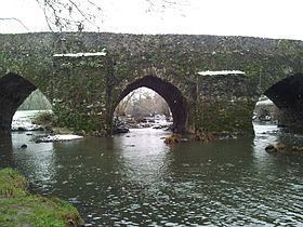 | ||
The Èvre is a 92 km (57 mi) long river in western France, left tributary of the Loire. Its source is at Vezins, 1.5 km (0.93 mi) northeast of the village. It flows into the Loire at Le Marillais, 3 km (1.9 mi) east of the village.
Map of L'Evre, France
The Èvre flows through the following communes in the Maine-et-Loire département, ordered from source to mouth: Vezins, La Tourlandry, Trémentines, Le May-sur-Èvre, La Jubaudière, Jallais, La Poitevinière, Beaupréau, La Chapelle-du-Genêt, Le Fief-Sauvin, Montrevault, Saint-Pierre-Montlimart, Saint-Rémy-en-Mauges, La Boissière-sur-Èvre, La Chapelle-Saint-Florent, Botz-en-Mauges, Saint-Florent-le-Vieil, Le Marillais
References
Èvre Wikipedia(Text) CC BY-SA