
Postal code 52xxx Elevation 22 m Local time Sunday 4:19 AM | Region Black Sea Time zone EET (UTC+2) Licence plate 52 Area 47 km² Area code 0452 | |
 | ||
Weather 4°C, Wind W at 8 km/h, 86% Humidity | ||
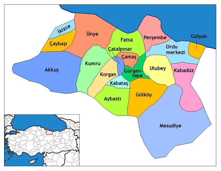
Çatalpınar is a town and district of Ordu Province in the Black Sea region of Turkey, 56 km from the city of Ordu and 20 km from the town of Fatsa. According to the 2000 census, population of the district is 23,192 of which 10,265 live in the town of Çatalpınar. The district covers an area of 47 km2 (18 sq mi), and the town lies at an elevation of 22 m (72 ft).
Map of %C3%87atalp%C4%B1nar, %C3%87atalp%C4%B1nar Mahallesi, 52300 %C3%9Cnye%2FOrdu, Turkey
The local economy depends on agriculture, particularly growing hazelnuts and grazing animals. There is a mineral water spring in the village of Elmaköy.
References
Çatalpınar Wikipedia(Text) CC BY-SA