
Country Canada Census division 15 Time zone UTC (UTC-6) Province Saskatchewan | Region Central Saskatchewan Established 1912 Population 1,840 (2006) Area code 306 | |
 | ||
Highways Highway 11
Highway 312
Highway 683
Highway 785 | ||
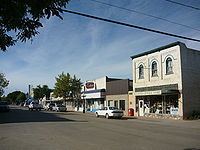
Rosthern No. 403 is a rural municipality in the Canadian province of Saskatchewan, located in the Census Division 15, just north of the City of Saskatoon, in the Central region of the province. The seat of the municipality is located in the Town of Rosthern.
Contents
Map of Rosthern No. 403, SK, Canada
Demographics
In 2006, the Rural municipality had a population of 1,840 in 525 dwellings, a 2.2% increase from 2001. On a surface of 954.66 km² it has a density of 1.9 inhabitants/km².
Communities
The following communities are located in this municipality:
Towns
Organized Hamlets
Unincorporated Hamlets
Attractions
References
Rural Municipality of Rosthern No. 403 Wikipedia(Text) CC BY-SA