
Country Iran Area 97,491 km2 Capital Semnan | Region Region 1 Population 631,218 (2011) | |
 | ||
Colleges and Universities Semnan University (Semnan), University of Shahrood (Shahrud), Semnan University of Medical Sciences (Semnan), Damghan University, Shahroud University of Medical Sciences (Iran) | ||
Languages spoken Semnani languages, Persian | ||
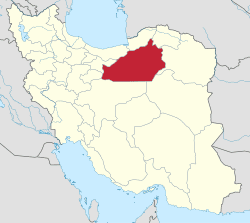
Map of Semnan Province
Semnan Province (Persian: استان سمنان, Ostān-e Semnān ) is one of the 31 provinces of Iran. It is in the north of the country, and its center is Semnan. The province of Semnan covers an area of 96,816 square kilometers and stretches along the Alborz mountain range and borders to Dasht-e Kavir desert in its southern parts.
Contents
- Map of Semnan Province
- Iran begins defense drills in semnan province
- Geography
- Abr forest
- History
- Orbital launch site
- References
The province was put as part of Region 1 upon the division of the provinces into 5 regions solely for coordination and development purposes on June 22, 2014.
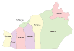
Counties of the province include Semnan, Aradan, Damghan, Shahrud, Mehdishahr, Meyami, Sorkheh, Garmsar, and Shahmirzad county. In 1996, the province had a population of about 501,000 (631,218 in 2011 ), and in 2005 Semnan city (the capital of the province) had a population of 119,778, and the city of Shahroud, which accounts for being the largest city of this province, had a population of 231,831. [1]
Iran begins defense drills in semnan province
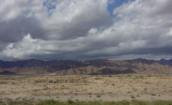
Geography
The province is divided into two parts: a mountainous region, and the plains at the foot of the mountains. The former offers a scope for recreational activities as well as being a source for minerals, whereas the latter encompasses some ancient cities of Iran as one of the capitals of the Parthian empire was located there. In Semnan, people have local language with special words and slang. the base of this language which it derived from is Pahlavi language the ancient language form Parthian.
Neighbours are in the north Golestan, Mazandaran, at the west Tehran, Qom, at the South Isfahan and at the East Khorasan-e Razavi.
Abr forest
This forest lies in the central province of Semnan, near its border with Golestan Province. It is one of the oldest forests in Iran which is a remnant of the third geological age. The Iranian Roads Ministry's decision to build a road through the forest sparked widespread protests last year.
The environmentalists, backed by the country's media, began a wide campaign against the ministry's decision, which finally led the Prosecutor General to order a halt in the construction of the road. However, all these efforts came to naught when it was announced in April 2008 that the government granted permission to the Roads Ministry to construct the road.
History
Semnan can be divided into sixteen sectors from the old days of Avesta. During the Medes and Achaemenid periods, it accounted for being one of the largest provinces of the empire, and today it roughly corresponds to the borders of the ancient region of Parthia.
During the Islamic era, Semnan was part of the historical region of Gomess or Komesh, and the Silk Road paved its way from the midst of this region. Needless to say, the province was witness to numerous wars.
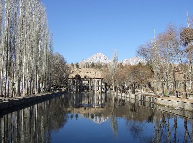
The Cultural Historical Heritage Organization of Iran lists 470 sites of historical and cultural heritage such as palaces, forts, castles, caravansarais, ab anbars, and badgirs, in Semnan. In addition to these there are various religious and sacred places as well.
Orbital launch site
On occasion of the 10th anniversary of the 1998 Kwangmyongsong 1 satellite launch attempt, program conducted by North Korea in close cooperation with Iran and Pakistan, the Iranian Space Agency has proceeded with its own test. According to practice also observed by North Korea, Iranian authorities announced to their Chinese allies on August 16, 2008 the imminent launch of a satellite. On August 17, 2008 on the occasion of the birthday anniversary of Shiites' 12th Imam Hazrat Mahdi, Iran proceeded as preannounced with the second test launch of a three stages Safir SLV from a site 35°14′5″N 53°55′15″E south of Semnan in the northern part of the Dasht-e-Kavir desert. Reza Taghizadeh, head of the Iranian Aerospace Organization, told state television "The Safir (Ambassador) satellite carrier was launched today and for the first time we successfully launched a dummy satellite into orbit". As reported in late 2009 and early 2010, a new, larger launch pad was under construction at 35°15′30″N 53°57′17″E