
Country United States of America Population 127,035 (2013) Area 36.223 sq mi | State California Mayor Carol Garcia | |
Colleges and Universities Heald College-Roseville, InterCoast Colleges-Roseville, Institute of Technology, Roseville Points of interest Golfland Sunsplash, Roseville Utility Exploration Center, All American Speedway, Roseville Telephone Museum, Maidu Museum and Historic Site | ||
Roseville (formerly, Roseville Junction, Junction, and Griders) is the largest city in Placer County, California, United States, located in the Sacramento metropolitan area. As of January 1, 2015 the State Department of Finance estimated the Citys population to be 128,382. Interstate 80 runs through Roseville and State Route 65 runs through part of the northern edge of the City.
Contents
- Map of Roseville California
- Homes for sale in roseville ca
- Homes for sale in roseville ca 916 2231765 christine bish
- History
- Geography
- Economy
- 2011 polish food festivalroseville california
- Great food in roseville california roundhouse deli
- 2011 polish food festival2 roseville california
- References
Map of Roseville, California
Homes for sale in roseville ca
Homes for sale in roseville ca 916 2231765 christine bish
History
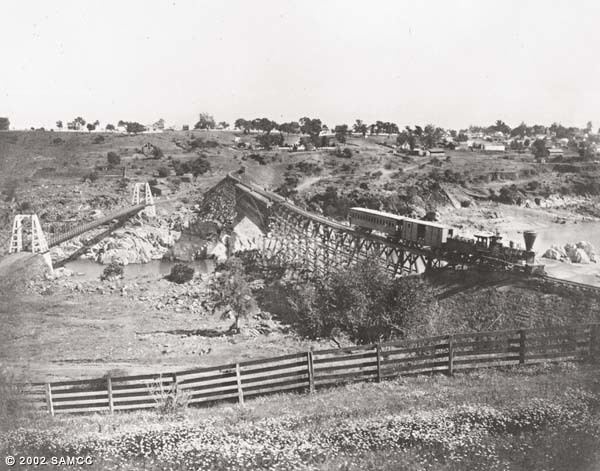
The settlement was originally a stage coach station called Griders. According to the Roseville Historical Society, in 1864 the Central Pacific Railroad tracks were constructed eastward from Sacramento, and when they crossed a small California Central Railroad line they named the spot "Junction." Junction eventually became known as Roseville. In 1909, three years after the Southern Pacific Railroad moved its facilities from Rocklin to Roseville, the town became an incorporated City. What followed was a period of expansion, with the community building more than 100 structures, including what was the largest ice manufacturing plant in the world (Pacific Fruit Express building, in 1913).
The City was a railroad town for decades, with the railroad employing up to 1,225 people by 1929, out of a population of only 6,425 people. With the onset of World War II the rail yards became busier than ever, and the post-war building boom brought continued prosperity. However, the nature of the City changed dramatically in the 1950s.
During the 1950s the railroad continued to expand and upgrade, converting its steam engine fleet to all diesel engines by the end of the decade. However, the railroads began falling in the shadow of air travel and the development of the national Interstate Highway System. Thus, although the railroad remained (and still remains) a major employer, the expansion of the City began branching out into other employment sectors. Another important change during this period was the Washington Boulevard (then called Seawell) railroad underpass construction in 1950. While this improved the ability of people to travel from one side of the tracks to the other, it meant that people were no longer traveling through the Roseville business district north of the tracks. The completion of Interstate 80 in 1956 shifted the population from downtown to what would become known as East Roseville. The old downtown area slid into a gradual decline.
The City saw steady population growth throughout the ensuing decades, as shopping centers, major retailers, and homes were constructed throughout the City. The growth rate was modest until 1985. Between 1929 when the population was 6,425 people and 1985, the population grew by only 22,563 people. In 1985 the population stood at 28,988 people. Five years later it was 44,685 people, and by the year 2000 it was 74,234 people. Some of this growth was fueled by the location of major employers, such as Hewlett Packard (in 1979) and NEC (in 1983). The population as of 2014 is 126,956 people.
While the character of Roseville has changed over the years, as the City grew from its small-town beginnings to its status as a major urban city today, it has retained some of its historic beginnings. Roseville is no longer a railroad town, but the Union Pacific Railroad is still the 6th largest employer (see Major Employers section, below). Current visitors can now visit the revitalized historic Vernon Street and old Downtown areas which had been in decline for decades, but were recently rehabilitated (see Revitalization section, below).
Geography
Roseville is located at 38°45?09?N 121°17?22?W.

According to the Roseville Civic Center, the city has a total area of 42.26 square miles (109.5 km2), of which, 42.24 square miles (109.4 km2) of it is land and 0.002 square miles (0.0052 km2) of it (0.00%) is water. Several streams flow through Roseville, including Dry Creek, Linda Creek, Secret Ravine and Cirby Creek.
Economy
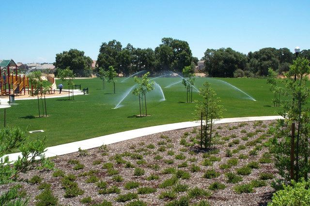
The city of Roseville has a variety of businesses located in it. It has encouraged the addition of large retail centers, including one of the largest Auto Malls in the country, which contributes significantly to sales tax receipts at the city and county level. Revenue from sales tax has been a main reason why the City of Roseville has been able to keep up the citys infrastructure as the population has dramatically increased. This environment has produced a mix of housing, small and large employers, as well as shopping opportunities. A popular water park, Roseville Golfland SunSplash, is also located in Roseville.